Showing posts with label Geography. Show all posts

Monday, February 4, 2013

Making your Neverland Coastline a Map

If you have not already checked out the Unit Resource Page, or the beginning steps, Modeling Your Neverland and Neverland Topography, simply click on their titles to link to these first steps and instructions.

Now that your child has a map of the coastline of his or her Neverland, he or she can fill in the land with landmarks and a variety of habitats.  In an open space on the map you'll want to place a Legend box.  Explain what a legend is and then fill it in with some of the kinds of symbols your child feels is most appropriate for his/her map. 

Encourage your child to include:
Forested Areas, Desert, Grasslands and other types of familiar terrestrial ecosystems,
Streams, Lakes, Rivers and other aquatic/marine ecosystems,
Magical landforms of his or her imagination - perhaps gumdrop fields, or an ice-cream glacier.

A Town or two and a "capitol city" with roads or pathways connecting each of these locations.

For older children, you might want to explicitely guide them into thinking about how the topography effects the likely habitation of the land.  To do this, overlaying their political information on their topographical information might help, but keep the topography lines very light so that they are mostly "covered" by the new map information.  Too many lines of equal darkness can become confusing.


You can see what Alice did in her map above.  You can also see how I gave her a couple of examples of symbols in the legend and helped her with the actual writing of the words in the legend some.

The map you see above is really only a beginning.  Over the top of this, can be added symbols for towns and cities, as well as names for locations right on the map.  To take the final steps, make light pencil lines to create a straight line where-ever a name is needed.  For example, over the central area of the "lagoon" in the middle.  Then have your child give a place name for each location. 

This is a fabulous chance to introduce or review proper nouns versus common nouns.  A lagoon is a common noun, but once it is named "Mermaid Lagoon" it becomes a specific place, similar to "girl" being a common noun but, "insert daughter's name here" (or use boy and a son's name) is a proper noun.  It is your child's job to offer up the proper nouns now for his/her Neverland.

Tuesday, January 22, 2013

Creating your Neverland Model

To help your child be prepared for this lesson, you will want to have lots of maps available for taking a look at before you begin.  In fact, I suggest having the maps lying around for a few days before and after this lesson in such a way they are easy for your child to access.  In particular, maps showing islands or whole continents will be most exemplary.

Other Materials:

clay or dough that won't dry out.
Airtight container with lid and stiff sides.
sculpting tools (optional - even toothpicks can be handy for the purpose though)
Sketch paper.
Dry erase crayons or markers.
A Hard and clear surface (I have a Plexiglas clipboard, but any surface the child can see through will do).
Overhead projector transparency sheet.

Make sure to point out the legend on the maps you are looking at for examples as well as the thought that a map is made in such a way as to give the user of the map a view as though one is flying right over the land and looking down on it.  Then, using clay or playdough, you'll want to actually mold an Island.  This one is your example.  While molding your own version of Neverland, show your child how to shape the dough so it makes beaches, hills, cliffs, plateaus, mountains, peninsulas, bays and lagoons.  If you want to do the landforms extension, now is the time to discuss the different landforms you want your child to learn.

It is also probably a good idea to have a "brainstorming session".  For this session, simply list all the things a good Neverland must have in the eyes of your child.  Are there fairy cities?  Should there be a pirate ship anchored in a cove?  Does your child's Neverland have animals from our world or only magical ones?  Which kinds of animals from our world?  Polar Bears, Pandas, Grizzlies or no bears at all?  Which kinds of magical ones?  Unicorns? Dragons? Wyverns? Wangdoodles?  Are there great big cities anywhere or is it mostly wild lands?  For any of the animals that exist, the child will need to incorporate the appropriate type of habitat for that animal into their plans.

If you plan on skipping the topographical portion of this activity, you'll want to read Chapter Four, while your child draws his or her island and move on to Making your Neverland Coastline Map.

While you read Chapter Four, your child can work on sculpting his or her Neverland.


When the clay model is completed, it is time to learn to "trace" its coastline. 

Place a piece of Plexiglas or other clear and hard surface over the top of the container the Island was built in.  Hand over a transparency and the thinnest dry erase marker you can find.  Start by tracing the island while looking at the tracing surface at a significant angle - 45 degrees should work nicely.  Show your child how looking at an angle distorted the map.  Erase the transparency and then have your child trace the coastline carefully again, this time looking directly over the center of the island.  This is also a tougher task than it appears so be patient and if a few tries are needed, just know your child is practicing his or her fine motor skills.  Particularly if you have a very young child (third grade or younger) if this is a struggle and becoming overly frustrating, "trace" the coastline together with both of you holding the pen.

For very young kids that will not also be creating the topographical map, just letting them sketch the outline of their island will suffice, but if you plan on doing topography as well, your child will need to practice tracing the coastline more than once  to get the coastline down in a precise manner.  You will want two copies of this coastline map.  One for the activity, Making your Neverland Coastline Map, and one to use in continuting with the Topographical step.

For the first Post in the Neverland Unit Series; Click Here.  

 Landforms Extension:

In order to use this opportunity to expand your child's vocabulary, introduce your child to a variety of landforms.  A few are already listed above but you might add, alluvial plains or deltas, an isthmus, sand bar or spit, reef, atoll, haystack islands, tombolos or tied islands, valleys, canyons, any number of other landforms you might frequently encounter where you live.

Here Alice is looking up different types of landforms

Make sure to take a look at what each land form looks like in photos or pictures of the land form itself as well as how it is mapped out on more than one example from your atlas or map samples you have out for the project.  Then give your child a list of landforms that must be included on his or her Neverland and encourage your child to start molding.  This task is tougher than you might think, so I suggest molding alongside your sweetie pie and if actually forming the clay into a particular land form is tougher than you thought it would be you can problem solve together.


NatGeo Land Form Education Resources

Wednesday, January 9, 2013

Your Child's Neverland

Today I am launching a unit with Alice that uses J.M. Barrie's Peter Pan as a launch point for a unit of study that will include map skills, geographical features, reading and vocabulary, descriptive writing and a little ecology.  I hope the unit will be a lot of fun and that some of my readers might join us on our journey and use the comments to chime in on highlights or challenges encountered during the Unit.  It should be a lot of fun.

Of course, as we read the story, I also had her define important vocabulary words, answer comprehension questions and do some typical Language Arts types of Activities.  There are many different versions of Peter Pan out there now, from the original, to Disney's version rewritten for book form and beyond.  Alice's School recommended an Early reader version, but she preferred an entirely different version of the book for its added complexity.  For that reason, it is difficult to offer helpful guides or even vocabulary lists here, but I will offer a "resources list" with links at the end of the article.  This article will focus more on my intentions for the "map" activities I am adding to the mix.


Objectives:

Students Will: 
  • Read, or have read to them, any version of J.M. Barrie's Peter Pan that includes the concept of all children having their own Neverland's already created in their own minds.
  • Create a political map of their Neverland
  • Create a topographical map of their Neverland
  • Expand their vocabularies in regard to Geographic Features.
  • Identify different types of geographic features such as mountains, mountain chains, island, isthmus, and peninsula.

Materials:

  • A copy of Peter Pan by J.M. Barrie - multiple adaptations out there are available at different reading levels.  The HarperFestival adaptation: Peter Pan The Original Story (the motion picture event) will work well for a slightly more advanced reader and there is a version adapted by Cathy East Dubowski done by Random House Stepping Stones written at a second grade level.  I'm sure there other adaptations out there that will work equally as well too.
  • Clay.
  • A piece of plexiglass or other hard and clear surface.
  • Lots of graph paper.
  • Writing paper.
  • Paper on which to sketch.
  • Typical classroom supplies such as colored pencils and/or crayons, writing pencils, and rulers.
  • An imagination.
  • An atlas or other reference for children about maps that will have examples of different types of maps.
  • You may decide to use a movie version of Peter Pan at some point during the unit as well.  There are still copies of the original play with Mary Martin available at some libraries and you can find it on Youtube as well (Here is part 1).  Of course there is the animated Disney version and the newer movie from 2003.

Activities:


Resources for Language Arts Activities:

Wikipedia: Typical Wikipedia Entry with synopsis, history and references to the author and his other works, other works inspired by the book, and additional information.
Book Rags:  Summary, Plot and Character Notes.
eNotes: Short Biography of J.M. Barrie, and links to character, plot, and theme summaries, essays and critiques, and an article about Media adaptations.  Membership is required for full versions of some of the articles, but there sufficient information for basics without as well.
Lit2go: Audio Version
Schvoong: Reviews, summaries and other information as submitted by Schvoong community contributors.  Things to think about.

Themes To Highlight/Research you and your child Can Do:

Then and Now - ask kids to compare:  
  • How Barrie depicts life at the Darling house and how life for children of the late 1800's and early 1900's compares to daily life for children now (in your location, or in UK compared to today's UK).
  • How people saw Native Americans in the early 1900's compared to how they are seen and understood today.

Historical Societies -
  • Life as a Middle Class Society Member in London in 1900
  • Native American Life in 1900 - you may need to choose a few representative tribes from different Regions in North America to narrow down your scope.  Make it clear there are multiple life styles that were lived at the time, just as there are multiple life styles lived for any other community in time.
  • Pirates from the 1700's- 1800's. 

Aging - The "Classic" aspect of this book and its major theme:
  • Some questions to ask:  Why doesn't Peter Want to Grow Up?  What is he afraid of?  What is so bad about being an adult?
  • Have your child define Aging.
  • Instruct your child to form an "interview" for each of her living grandparents, or other family members that are retired or near-retirement.  Have your child use the interview to discover what growing up was like for them and how they see aging.  Have your child ask you (or another person in mid-life) the same interview questions.  Draw connections between answers by comparing and contrasting.
If you have more wonderful thematic ideas, Please share them in a comment.  I hope this article will act only as a starting point and inspiration for further development.

Sunday, August 5, 2012

How Much Water?

Teaching Kids that the Earth's surface is covered with mostly water is one of those things that is a basic piece of knowledge they are expected to obtain at some point in the science or geographical education.  This was an activity I regularly used in my sixth grade classroom (doubled as a lesson for practice with calculating percents as well) and have used in my home school classroom with my daughter (first grade) with great success.  This is a great lesson to do prior to "A Drop in the Bucket" (The directions for which are soon to follow).

Minimum Prior Knowledge:

To complete this activity at its most basic level kids must be able to:
  • Differentiate between ocean and land surfaces on Earth.
  • Understand that a globe is a model (like a "toy version") of the world.
  • Count to 100.
  • Keep a Tally
  • Need to have been introduced to the Scientific Method.
  • If you will expect the child(ren) to calculate percents, they will have needed an introduction.

Materials:

  • First, you'll need an inflatable globe (beach ball painted as a map of the world) for every three to four children in the group with whom you will do this activity.
  • paper or composition book for each student
  • pencils
  • Two or more People including yourself.

Time:

How long this will take will depend somewhat on the age of the children with which you are working, but the whole lesson will take about 40 minutes minimum.

To Do:

Start by asking kid(s) if they know the four oceans.  Write a list on the board.  Then, make a second column and list the continents.  Now ask the kids whether they think more of the Earth's surface is covered by water or by land.  Because of the list you just made, many of the kids are likely to answer land.  This is GREAT.  Just write it down on the board  (or paper) as a hypothesis option as well as the opposing answer that most of the surface is water.

Bring out one of the globe beach balls and ask the kids to look at it to decide on which answer will be their final choice while you turn it around for them slowly.  Point out each of the four oceans and the continents as you turn the globe.

Have your child or students copy down the hypothesis they think is true in their lab books or on their paper.

Now, with a volunteer student, play catch.  After each "catch" figure out whether your index finger (of a pre-determined hand) is on land or on water (ocean, sea, lake - doesn't matter.  If a finger is on both, just re-toss).  Tell the learner(s) you expect about 75 of the tosses to land on one and 25 to land on the other (clarify this is a giver or take kind of a number).  When you get to one hundred tosses that count it will most likely be something around 75-water, 25-land.  If you are doing percentages, have your child/class calculate the percentage. 

Have your child(ren) tell you whether your experiment shows that there is more water or whether it shows that there is more land.  It is likely your child(ren) will wonder if you just got lucky or not.  Take them all outside and set a few ground rules to help with management (do what you need to in order to pre-emtively prevent balls from going over fences, dodge ball games from beginning etc.  For example, you may remind them what a "gentle toss" looks like and specify you expect only these kinds of throws). 

If you have a whole class, have the kids break into smaller groups of 3-4 kids and try the experiment again.  Each group will need a record keeper to keep a running tally for the group of "land" vs. "ocean".  If your kids will be doing percentage practice, just give them a certain amount of time and when time is up give them 5 minutes to make sure every one in the group has the data.  Go back to the classroom and give your kids a little time to calculate their percentages.  A member from each group should then report its number findings and percentage to the whole class.  For homework, have the kids calculate the whole class percentage (showing their work) and then analyze the results and write a conclusion that states whether or not the test showed there to be more surface covered with water or with land.

If you have younger kids, have them report their numbers to you and calculate an entire class percentage for them.  Discuss with them what the numbers mean in terms of more water or more land.  Go ahead and talk to them briefly and simply about "percentage" just describing that it is a way of saying "this many times out of one-hundred" or as a way of saying, "if the world's surface was in 100 pieces, this many would be covered by water and this many would be covered by land".  Have the kids copy the class conclusion about water or land into their science logs or onto their papers.

A Great Resource for Follow Up Ecological and Science activities about water and water use.


Tuesday, July 31, 2012

Geography - United States Picture Books

I started to write this blarticle before the fourth of July with the intention of publishing it around the holiday.  However, I'm still waiting on a few books such as, "The Little Man in The Map" by E. Andrew Martonyi.  I'll add and update as more books arrive.  Here are the quality books we have found so far. 

Nice to Have on Hand for Reference:

This listing of books includes the books I have found that I either have on hand for reference already, or believe would be a wonderful addition to our ever growing collection.  These books are not really the type a child wants to sit down and read, however, they offer wonderful illustration and information that would help elaborate upon and enrich, trips across state lines and general experiences relating to the geography, natural history of political history of the states within our nation.  We also regularly refer to a Rand McNally Road Atlas and a Wall Map.

Greetings from the 50 States - How they Got Their Names:

This book by Sheila Keenan and Illustrated by Selina Alko has a two page layout for each state.  The illustrations are done as a whimsical and decorative map of the state showing its seal, important landmarks in the state, animals and colors that characterize the state and additional illlustrations depicting something historically important to that state.  The main body of text gives about a two paragraph synopsis of how the state came to earn the formal name it was given.  There is also a secondary bit of text about at least one of the state's nicknames - such as the sooner state, granite state or evergreen state. 

Quilt of States - Piecing Together America:

Adrienne Yorinks made beautiful quilted maps to depict each state as well as maps to depict the entire nation (or at least the lower 48) in 1790, 1803 (fter the Louisiana Purchase), 1820 (Missouri Compromise), 1848 (Mexican War), 1861 (secession), and between 1912 and 1959 before the admission of Alaska and Hawaii.  There is one final map that shows Canada as well as the US in order to include those to final states   where they actually belong on the map.  With the help of 50 librarians from across the country, each state is depicted with a brief summary of the essential aspects of the state's history in terms of how each state became a state in the first place.  Along with each larger map there is also a brief description of the stage of history the map is depicting and what was happening to cause more land acquisition (or the division of the country as in the case of the map depicting our country at the time of the Missouri Compromise and the Map of Secession).  This is, as usual for National Geographic Books, a beautifully done book.

For Reading:

A is for America - An American Alphabet:

NOT to be used as an alphabet book, this brilliantly illustrated book by Scillian is full of tidbits from critical junctures in our history, geographic and historic monuments, important figures from our past such as Babe Ruth, Thomas Edison and Hariet Tubman, and even includes things such as Oreos and zippers.  Pam Carroll's illustrations are a feast that almost seem as though they came first, except they correspond too well with the text for that to be true.  Great for primary grades as a read-aloud.

Scrambled States of America:

This brightly illustrated book has Uncle Sam tell the story about the time all the states decided to switch places with each-other.  It provides an introduction to the states in a general, funny and lighthearted way.

For Perusing:

United Tweets of America - 50 State Birds:

This book by Hudson Talbott shoes that he really has a sense of humor!  With a page for each state (and district), it also contains a little more than just a listing of state birds with little bits of trivia for each state.  Lots of fun for the 8 or 9 year old jokester learning about our country.

America the Beautiful:

Even if you have this wonderful poem by Katharine Lee Bates memorized line for line (or lyric by lyric as it is now known in song, this book is well worth the perusal.  Chris Gall's brightly colored and detailed illustrations draw you right in.  He has really illustrated his great-great-grandaunt's poetry with grace and depth.  He chooses a wide range of moments in our history to illustrate as well.  The pages depict the vast variety with which our nation abounds from a landscape depicting a lighthouse and the edge of the sea across rolling wheatfields to desert mesas and of course "purple" mountains.  He also manages to encompass major moments in our histroy from the Lewis and Clark expedition to the building of our railroads and sky scrapers as well as the incoming flow of immigrants and even 9/11 with one page depicting the firefighters errecting a flag on the ashes of the twin towers in New York.  He also squeezes in different seasons, and important symbols.  I put this one in the "perusal" category because it could be gone over again and again just looking at the gorgeous prints on each page.  An adult needn't know the title or the lyrics to understand what this book is about.  What wonderful conversation starters about this countries geography, culture and history this artwork is.

State Shapes Series:

I read the one about Washington and it was fun  and had a lot of good information, but I did find a few inaccuracies, so use it for fun, but if your kids are using it for research make sure they double check thier findings.

For those Readers with a Daisy Scout:

The Daisy scout's "Between Earth and Sky" journey is a perfect one to accompany a road trip or unit on US geography.  Alice and I have been working on this journey over the summer and will add to it during our trip as well.  Since Alice is not part of a troop and we are "Juliette Scouts" that meet with a few scattered friends that are also "Juliettes" we work in Journeys as thought they are almost like a Unit Study where we can.  If are a family with a daisy scout working on US geography, seeds, habitats, or a host of other scientific and/or ecological topics, this journey will tie in nicely for you.

Your Input:

If there is a book you have read or heard about you would like to review that is not already on the list, please feel free to share what you think.  Even if it's something you haven't read it yet, I might be able to find it and add to the list - just ask.

Tuesday, July 24, 2012

Upside Down Hike

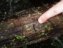
Looking for something different to do this summer?  Go on an upside down hike.  This hike is not taken walking on your hands - though if you can walk on your hands up the hiking trail your young child will LOVE you for it (talk about coolest parent in town!).  Instead, it is an upside-down hike because you turn over rocks and logs and things to see what you can find underneath.  You are turning things along the trail upside down.  Wear a pair of gardening gloves (prevents most scratches and bug bites), sunscreen and a wide-brimmed hat.  I also recommend wearing long pants to avoid brushes on the legs against thorns and toxic plants.  Review your toxic plants before you go and avoid poison ivy in addition to anything else that might cause problems like nettles.  It also might be helpful to have a magnifying glass and field guide about amphibians, insects and reptiles common to your area.  You can find all kinds of things under rocks and logs that will be fun to observe.  Please try to mind your trail manners and return rocks, animals, logs, twigs and any other native object you move back to its original position before moving on further down the trail (this keeps the interesting life you've uncovered, healthy and alive).  Enjoy what you see together.

Art/Science: practice sketching some of what you see along the way together.

Writing Skills: Have your child write a description of a favorite critter that was found along the way.  Or have him/her sit quietly and describe what he or she observes while sitting there.  Suggest using all the senses as starting points for this type of a journal entry.  What does your writer see? smell? feel? etc.

Geography/Map Skills: Make a map of the trail as you walk it, draw in landmarks together.

Reading/Literature (mostly non-fiction): Check out any of the numerous books on insects, lizards, or reptiles you might find under the rocks and logs you overturn.  A perfect one for this activity is Minibeasts Under a Stone.  Read the books together before you go and then make a picture book together of your finds after you've returned.

Science: Learn what makes a bug a bug, and an amphibian an amphibian etc.  There are numerous book resources about this topic and activities to do to really make learning about these critters fun. If you really want to learn more about Creepy Crawlies spend some time with it and make your upside down hike the introduction or the finale - either way its lots of fun.  Here is a link to many internet sources and not surprisingly, the San Diego Zoo also has some info on the matter for kids.

Friday, May 4, 2012

Geography in your Household


We've all seen the bits on the news (or on shows like letterman) where adult US citizens can't even Identify the United States on an unlabeled map.  Trouble is, despite the fact that our world is becoming more and more "connected" and interconnected.  Geography is not formally addressed in most school curricula.  It is simply assumed that it will be handled as a part of social studies but there is not necessarily some one overseeing that there aren't gaps and/or repeats in what is taught over the entire course of geographical encounters in a given student's education.

National content standards are available as suggestions and state standards are adhered to within the state many states (even in the private schools as a part of their accreditation requirements).  However, standards are often vague and in the case of the subjects such as science, social studies and the arts are generally just left up to individual teachers to address or not during most of the elementary school years.  These subjects - at the Elementary level - are seen as secondary and inferior in importance to reading, writing and 'rthmatic.  This means that when it comes to geography in particular, the standards for one grade my be addressed systematically but at the next grade level they're hardly considered.  Of course some schools are more systematic than others however, by the time our children get to Middle School many students have fallen way behind when compared internationally (of course, they also fall way behind in mathematics as well).  

So, in your busy schedule what is a parent to do?
Alice's Imaginary World
Map to Treasure Island
For starters, having a world map hanging somewhere in your home that the whole family can easily see and access frequently has advantages for all of the subjects your child will study in school.  Places of the world come up while watching the news, reading books, learning about biology and ecology etc.  Even in high school chemistry where scientists were from or where a discovery was made is often shared or discussed. There are also mathematical concepts and skills introduced through using a map.  It only takes an extra minute or two to locate a place on a map.

Preschool and Early Elementary:  
Children at this age are only beginning to imagine a world beyond their own. The youngest members of this group are not really ready to understand geography in its traditional sense until they begin to engage in imaginary play with others so don't expect a lot of recall.  However, you can begin to introduce them to maps and the idea of different places.  By watching you locate and talk about distant places with the younger child him/herself or with an older sibling the idea of the map and the idea that there are places in the world other than those you regularly visit is introduced.  More and more of the information that is imparted in this way (in little tiny spurts here ane there) will be gleaned and retained as your child ages and starts to recognize patterns in your actions and discussions.

Introducing what maps are through play is another GREAT way to get them started.  During some family time go on a walk and draw a map together of your neighborhood.  Talk about the map showing your neighborhood they way a bird might see it.  Discuss the "culture" of your neighborhood.  What makes it unique to other neighborhoods?  

On another family day, you can map out an obstacle course on paper and then create the obstacle course in your yard.  

When reading a book with 'real" places, go ahead and point those places out on the family map.  In Mo Willems' series Knuffle Bunny, the family goes on a trip to see Sonja's Grandparents in the final book, "Knuffle Bunny Free".  What a great opportunity to just point out this journey quickly on a map.
Many games (video games too) involve a map-like board or view of the video game world.  For example,  Candyland is laid out on a game board presented as a cartoon-style map.  Pixie hollow has been mapped out by the creators of the Tinkerbell movies and made into an online video game complete with a map of pixie hollow.  Although I do not suggest this is a GREAT learning tool, I do offer it as an example of the kind of thing you might run into with your four-year-old or early elementary child that can become an opportunity to discuss how maps symbolize the greater world around us (or imaginary worlds we create).

You can also check out the articles "Map Happy" and "Geogrpahy Safari" on this blog for two activities to do with mature preschoolers, kindergartners or first graders.

Elementary 
After you've introduced your child to what a map is, If you have a particularly imaginative child, you might ask him/her to draw a map of the worlds he or she creates in his/her play while you make dinner.  Then discuss that world and what the map shows about that world with your child during your dinner discussions.  

We all know about Dora the Explorer and her cousin Diego.  These cartoons are fun and entertaining for our kids.  They do not explore either geography, or Spanish as deeply as they may want parents to believe, but they do introduce the idea of a second language and second culture . . . and Dora uses "Map" in every episode.

V-tech has a globe where your child can "fly" a plane around the globe and depending on where they "land" the globe states little bits of information about that place.  Then there are follow up games where the globe asks the child to find something and the child "flies" the plane to the something that is being looked for.  They also offer other games and tools related to geography for various ages.

Two great picture books I read with my own preschooler are Grandma went to Market by Stella Blackstone and All in Just one Cookie by Susan E. Goodman.  These are so memorable that even though I initially read them to my little one months ago she has asked that we check them out from the library again.

There are puzzles of the United States and of the World available that offer the opportunity for your child to play around with his/her spacial skills while becoming familiar with the shapes of the continents or states.

A treasure map and treasure hunt is a classic "pretend" for our preschool-Elementary aged children.  Go ahead, "bury" a treasure and then give your child a map to a clue where another map is found etc.  This activity will probably be asked for again and again.


Reading Maps and Math Share a certain number of vocabulary words and skills that can easily be practiced when the family has a wall map to refer to frequently.

Math and Map Vocabulary
Directional Words - East, West, etc.
Distance Words - far, farther, farthest, near, nearer. . .
Distance Measures - Miles, Kilometers, Inches. . .
Estimation
Using Symbols to represent an entire idea.  For example: + in math, Little people for restrooms on a map.

For Kids of Any School Age:
Things for which you can use your map:

Place pins or tacks in the places you've been or where you will be going.  Compare distances.  Depending on the age of the children, this comparison can be as simple as, "which place is the furtherst" or as complex as estimate the number of miles to the last family vacation location and then guess how much further we'll be going this year.  Older kids might even measure out the route and use the map scale to calculate actual distances.  A pre-algebra student might get asked, "If we traveled at 65m/hr the whole time, how long will it take to get there?"  Include family member's homes on the map if you have relatives in distant places.

Find locations mentioned in books that are read, movies that are seen, or news articles you read together or newscasts you watched together,  You can consider the same types of questions as presented in the paragraph above for these locations as well.

You can also identify locations of importance to school projects and discussions on your wall map.

Please feel free to add your own creative ideas by making comments below.  I know there are other wonderful books and games out there too, please inform!